

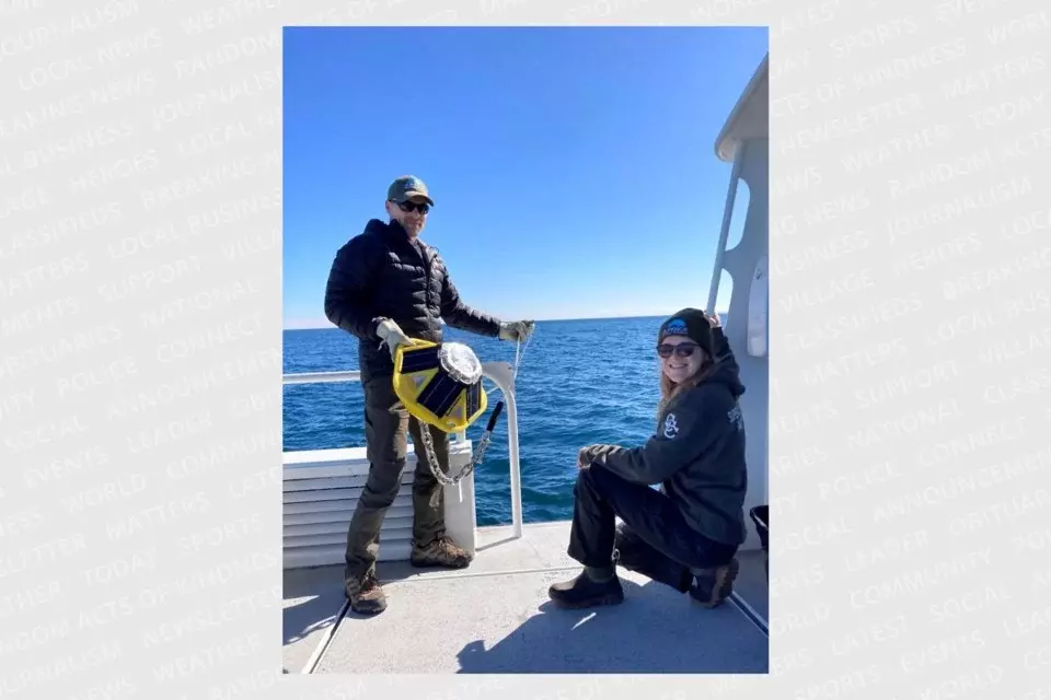
Three climate monitoring and maritime safety buoys have been deployed for the season from the south shore of Lake Superior. The Superior Watershed Partnership (SWP) staff deployed the the buoys with boat support provided by the Michigan Department of Natural Resources (DNR) and Pictured Rocks National Lakeshore (NPS). The location of these buoys are near the shorelines of Marquette, Munising and Grand Marias. The Marquette buoy is one half-mile northeast of Black Rocks off Presque Isle; the Munising buoy is five miles north of Miners Castle, Pictured Rocks National Lakeshore; the Grand Marais buoy is one and a half miles north of the harbor. In 2021, the SWP received $47,786.80 in grant funding through the Great Lakes Observing System (GLOS) to purchase these new, innovative buoys–and SWP continues to deploy, maintain, and retrieve them yearly.
Each of the three monitoring buoys collect important navigation and climate planning data including wave height, wind speed, water temperature and more. The live data provided by these buoys is critical for commercial and recreational boaters as well as the National Weather Service, Environment Canada and NOAA. In addition, the SWP uses buoy data for long term climate adaptation planning with coastal communities in the Upper Peninsula.
Data is transmitted and accessible via the GLOS Seagull website: https://seagull.glos.org/ or through the SWP’s website: https://superiorwatersheds.org/superior-buoys.
Are you interested in supporting the continuation of SWP’s buoy program?
SWP is accepting donations for the annual fee required for data transmission. Donations can be made at: https://superiorwatersheds.org/support/donate, by contacting Jeff Koch (SWP) at [email protected] (906) 228-6095 ext. 18